English-language version of Luistxo Fernandez's blog
Free Electrons?
Tabacalera is in the process of becoming a proper museum, but meanwhile it uses its vast spaces to host things. Last sunday we went as a family to see video-art. Short arty films of some Lemaitre collection, brought together in a show called Free Electrons.

I made some shots (no flash) with my phone, and here comes the security agent. No photos allowed. I protested, we are against the tiranny of privative copyright and we believe art should be free. At the end, the guy accepted a technical excuse: I was making shots of my family. Yes, look at the interferences caused by my son with his toy plane.
If revolutionary art needs millionaire public funding to exist, so it be: after all, modern art is fun to see, and having it near home is good for family life. But I won't abide by the authorities' restrictions over the right of taxpayers to document our lives and cities. Free Electrons? Let them be truly free. When possible, I will keep shooting at Tabacalera, and my photos will be copylefted here. I'm not an artist, but I'll try to be loyal to the true spirit of avantgarde art.
Ignite talk at Where 2.0
More importantly, this time, I have to address the audience of Where 2.0 with a Ignite talk about Tagzania! 5 minutes, 20 slides in a presentation that I won't control (slides pass every 15 seconds till the 5 minutes are consumed).
Hopefully, the best Californian blogger of the city I live, Wheylona, will help me polishing my pronunciation and delivering some surf-related jokes. ¿Or will they be about Schwarzenegger?
Personal geography and Tagzania
I think rumours about the death of sites like Tagzania, the geo-mashups, have been greatly exaggerated. That's the tone of several posts commenting on the irruption of My Maps in Google, but I see G My Maps as a positive move towards a wider adoption of the concept of “personal geography”, which I think is an idea not very much extended among mainstream Internet users, and I see opportunities there for Tagzania, one of those social mapping apps.
It’s also interesting to see Google catching up with concepts that we had clear when we launched Tagzania.com in 2005: create your maps, adopt GeoRSS… Obviously, we have to push further, being ahead of Google is like an interesting challenge.
On the business level, others will feel more pressure. Ours is a side project for a small company, sustainable so far, and feeling no pressure from investors or the bubble-burst-buzz around. Our focus is strengthen the features of Tagzania to better please users, and don’t care much about Techcrunch gossip or how others may be sweating. As for the big actors, Google, Yahoo: We at Tagzania see their adoption of standards as a positive move, and the availability of APIs and web resources that precisely those giants are pushing, that’s only good news for us. Then they add direct services that start-ups have imagined first, but, of course, we know that’s going to happen some day, with this, that and many other things. But there’s room for niches and tailored community websites or services, no doubt about this.
The multilingual twitter
However, I like Twitter. Now I go out 10 days for holidays, no web surfing surely, but i'll post in the Internet with SMS these days. It will be there, in Twitter. You may follow me, but cannot promise you'll understand me.
Catalan geodata freed
It's a set of over 1800 municipalities in the territories where Catalan is spoken.
The bombings of Durango and Gernika
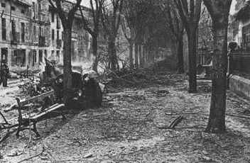
Some 300 people died in Durango that morning. My father survived, without injuries, surrounded by debris, in the middle of Ezkurdi square, right here. Then a teenager, now he's 85 years old, and he's quite well at his age, he remains an avid reader of history books. Memory and history have retained the name of Guernica (Gernika), the city destroyed by a similar bombing some weeks later (april 26th), although the number of mortal victims was probable lower in Gernika than in Durango. However, not just italians, but Nazi germans of the Condor Legion of the Luftwaffe took part on that attack, and the physical destruction of the city was bigger.
Germany has apologized for Gernika. I haven't heard a word from the army of Mola and Franco, the Spanish army.
Ten years ago, I was a journalist for Basque newspaper Euskaldunon Egunkaria, and I wrote (together with Basque historian Josu Chueca) a report about Durango, using, among others, the direct account of my father (I showed little modesty, you see). That series of reports about the Spanish Civil War in the Basque Country was converted into a book by Egunkaria. Then, in 2004, Spanish judges closed Egunkaria: the material written content of that newspaper, including my half-book, remain hijacked by the judge. No, that's not Turkey, it's the European Union, basque newspapers are closed under unproved accusations of terrorism, it's former directors were tortured... Three years later, not a single evidence of links to terrorism have surfaced anywhere.
The perpetrators of Durango's and Gernika's bombings still have streets named after them in Spain.
Great and well documented Flash reconstruction here: the criminal Bizkaia campaign carried by fascist forces in the spring of 1937, one of the darkest moments of the Spanish Civil war.
Basque geodata free on the web
Nearly 250 locations have been corrected (moved to exact positions, and official and alternate names have been added, mostly in Basque), and other 750 new records were added, populated places most of them. The data set is from the Provincial Council of Gipuzkoa, the regional administration, and has been kindly provided by the officials in charge of the local public Spatial Data Infrastructure (SDI), the B5M office, as it is called there.
I took part on it, just brokering the contact, convinced B5m about the utility of open data and Geonames, and Geonames about the interest of the data provided. There are other wikipedia-like Geographic sites out there, but for me, Geonames is the Wikipedia of geography.
Previously, Gipuzkoa’s places looked like this in Geonames:

A regular distribution pattern of some scarce populated places, due to rounded coordinates of old gazetteers. And only Spanish names appeared, despite Basque forms being the official ones for 20 years or so. Now, that region appears like this:

More places, updated Basque official names show first (Spanish names haven’t been deleted, they remain there as alternate form), and exact locations. In the case of municipalities, for instance, latitude and longitude are those of the town hall.
Polar year

Will our children play with our grand-children as happy as we did with them some days ago? It's a good day to think about ice, snow, receding glaciers... Let's support IPY related activities around the world.
Free maps in Baghdad and closer...
World coverage varies greatly, but London and the UK look great, and then there's this new effort for Baghdad, something promising, in my view.
And besides, there's Eibar, my hometown, and workplace:

That's the first free and open map of some piece of the Basque Country, a bunch of roads and streets in Eibar, traced by my coleague Gari Araolaza.
Is there any OpenStreetMap coverage around your place? Tagzania let's you check that. Below every individual map, there's the option to open the OpenStreetMap link to look.
Satellite gets closer to this Cemetery
Finally, the place where I work is decently viewable in Tagzania. See the screenshots in the Basque side of the Cemetery or at my Flickr set, the Basque Country from above, as seen on the web.
And when I leave the workplace, I go to a city that looks much more pleasant now:

Previously, Donostia looked awful:

There has been a great satellite imagery update in Google Maps, that also reaches Tagzania and the other mashups based in the API.
The whole Basque Country is now at a resolution of 2.5 meters, at least in the areas of low resolution that were seen as in this screenshot above. That's not as detailed as the previous hi-resolution cities that could be accessed until now, but it's much more better than the average low-resolution areas.
Waiting for Godot
That ended last saturday. ETA put a 500 kilo bomb in Madrid's Barajas airport, two young immigrant workers were killed by the explosion.
Yesterday, a political leader for Batasuna (Pernando Barrena) spoke: they have no indication, he said, that ETA has broken the ceasefire. They're waiting for a communication from ETA. No further explanations for what happened. Analysis is pending: let's wait for the communication. They'll think about what happened after that.
Waiting. Waiting for Godot. A brilliant Basque writter and blogger, Anjel Lertxundi, found this analogy. I just may add the original text from Samuel Becket's masterpiece.
ESTRAGON: (his mouth full, vacuously). We're not tied?
VLADIMIR: I don't hear a word you're saying.
ESTRAGON: (chews, swallows). I'm asking you if we're tied.
VLADIMIR: Tied?
ESTRAGON: Ti-ed.
VLADIMIR: How do you mean tied?
ESTRAGON: Down.
VLADIMIR: But to whom? By whom?
ESTRAGON: To your man.
VLADIMIR: To Godot? Tied to Godot! What an idea! No question of it. (Pause.) For the moment.